
Address the backlog of collected research specimens that...
*This is a 2018 archived project, view this year’s projects here.
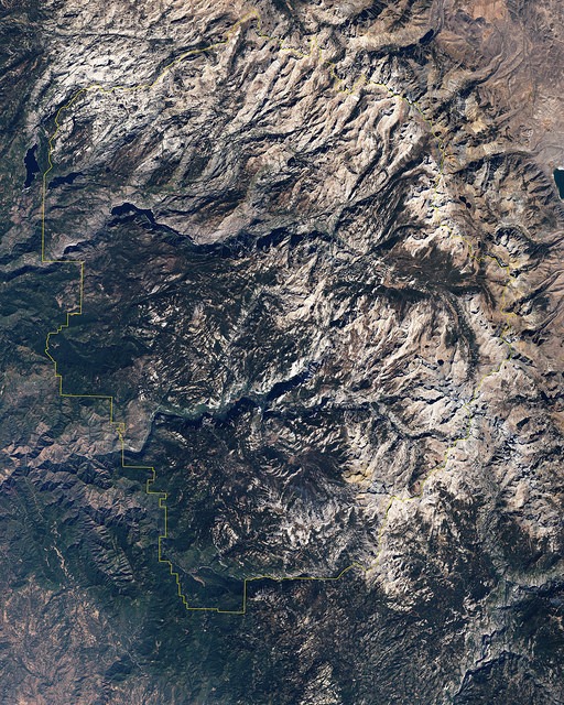
Yosemite has long served as a living laboratory, a hub for studies in many fields. Now, cutting-edge technology is giving scientists the chance to propel park research to a new level: sky-high!
In 2018, with your support, scientists will use data from airborne laser scanning (Light Detection and Ranging, or LiDAR) to produce a high-resolution 3-D map of Yosemite. In addition to featuring structures and terrain, the map will offer information about forest health, revealing dead or dormant trees. Park experts will be able to use the data to study drought impacts, examine geologic hazards, flag areas threatened by invasive plants, identify habitat for special-status wildlife, refine fire-management strategies, plan restoration projects, better understand the effects of climate change and more.
Your support will fund a groundbreaking, critically important scientific endeavor to help preserve Yosemite for years to come.
Partnering with Yosemite National Park, NASA Jet Propulsion Laboratory, and U.S. Forest Service Remote Sensing Lab.