For decades, research scientists in Yosemite have had a huge problem to solve: how to study the sheer scale of the park. While it is possible to study small areas and collect and aggregate mean data to predict results, it proves difficult to fully understand the delicate and myriad ecosystems within the 1,187 square miles of the park. Thanks to technological advances, however, scientists are able to map not only the topography of the land, but also the habitats and flora and fauna to which Yosemite is home.
You may have heard lidar mentioned in some of our project updates. Developed in the 1960s, lidar, which is short for “light detection and ranging,” is closely related to radar and sonar technology. It is, fundamentally, a remote sensing tool. Lidar works by using a laser beam to determine the distance to an object. The beam of light hits an object, then travels back to the sensor. A microcomputer inside the lidar sensor measures the time it takes for this light to return to the sensor.
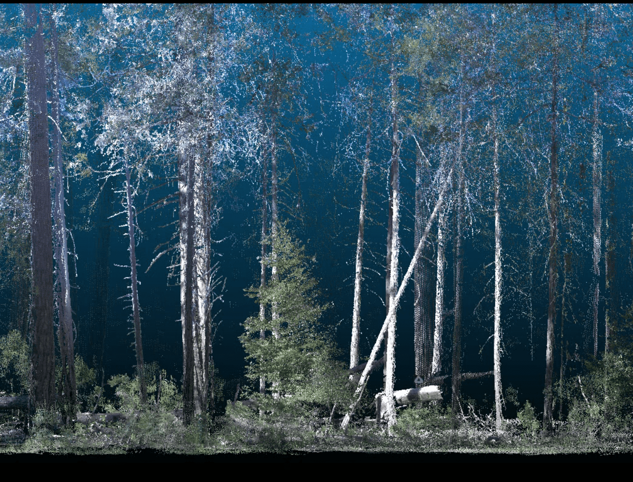
This image capture from a 3D model animation shows the fine-grain detail terrestrial lidar can pick up. Researchers are able to completely map the forest from ground to canopy using lidar, which enables them to recreate the forest in its entirety, and establish which habitats are more vulnerable to fire — and how they can best be protected. Image courtesy of Athena Demetry/NPS.
Since the sensor also knows the speed of light is fixed, the sensor can then calculate the distance to that object. Due to the accuracy of the technology, it is frequently used in aircrafts to ascertain distance to the ground. It is also used in a number of Conservancy-funded projects in Yosemite. From mapping the habits of songbirds, to assessing forest vulnerability, lidar is a core tool for understanding both the land and the environment.
Greg Stock, a Yosemite National Park geologist, is studying disappearing snow in the high country. His goal is to understand declines in the perennial snowfields in Yosemite, as well as in the Lyell and Maclure glaciers (work that started with John Muir in 1872). The oldest snowfield records, from the early 1900s, are historical photographs and topographical maps (courtesy of U.S. Geological Survey records). In the mid- 1990s, satellite imagery was used to map the park, and lidar was used beginning in the Tuolumne watershed in 2012 and in the Merced watershed in 2014. It is likely that more water is stored in perennial snowfields than in glaciers and that storage is being lost to warming temperatures and drought. The goal of Stock’s research is to learn more about the impact climate change has on the snowfields and to make the first major effort to track trends in snow patches. This will let scientists estimate when remaining snowfields might disappear and determine what the loss of that snow will mean to streams that drain from them.
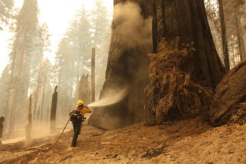
A combination of both aerial and terrestrial lidar is essential for forest mapping. Chad Anderson, one of Yosemite’s landscape ecologists, is working on a Conservancy-funded project to assess forest vulnerability to drought and fire, and to study tree mortality. The lack of road networks in the park makes remote sensing a necessary tool to measure changes on the ground, with a goal toward making a working model that can evaluate trees on an annual basis. Subsequently, researchers will be able to rapidly assess outcomes of fires and determine where the best locations may be for prescribed burns to improve wildlife habitat and reduce the chances of high-severity fire. “We have never been able to capture the state of the entire forest at once,” Anderson says. “In a good year, with a well-funded crew, we could visit a couple of hundred plots. In a 900,000-acre park, we could assess only a few hectares. We want to understand the structure and the health of the forest on a park scale. Lidar gives us the ability to assess the park’s health over vast scales.” For the first time in Yosemite’s history, we will be able to get a boundary-to-boundary 3D view of the entire park in full color, thanks to the combination of increased computer-processing speeds with advanced lidar and other satellite technology.
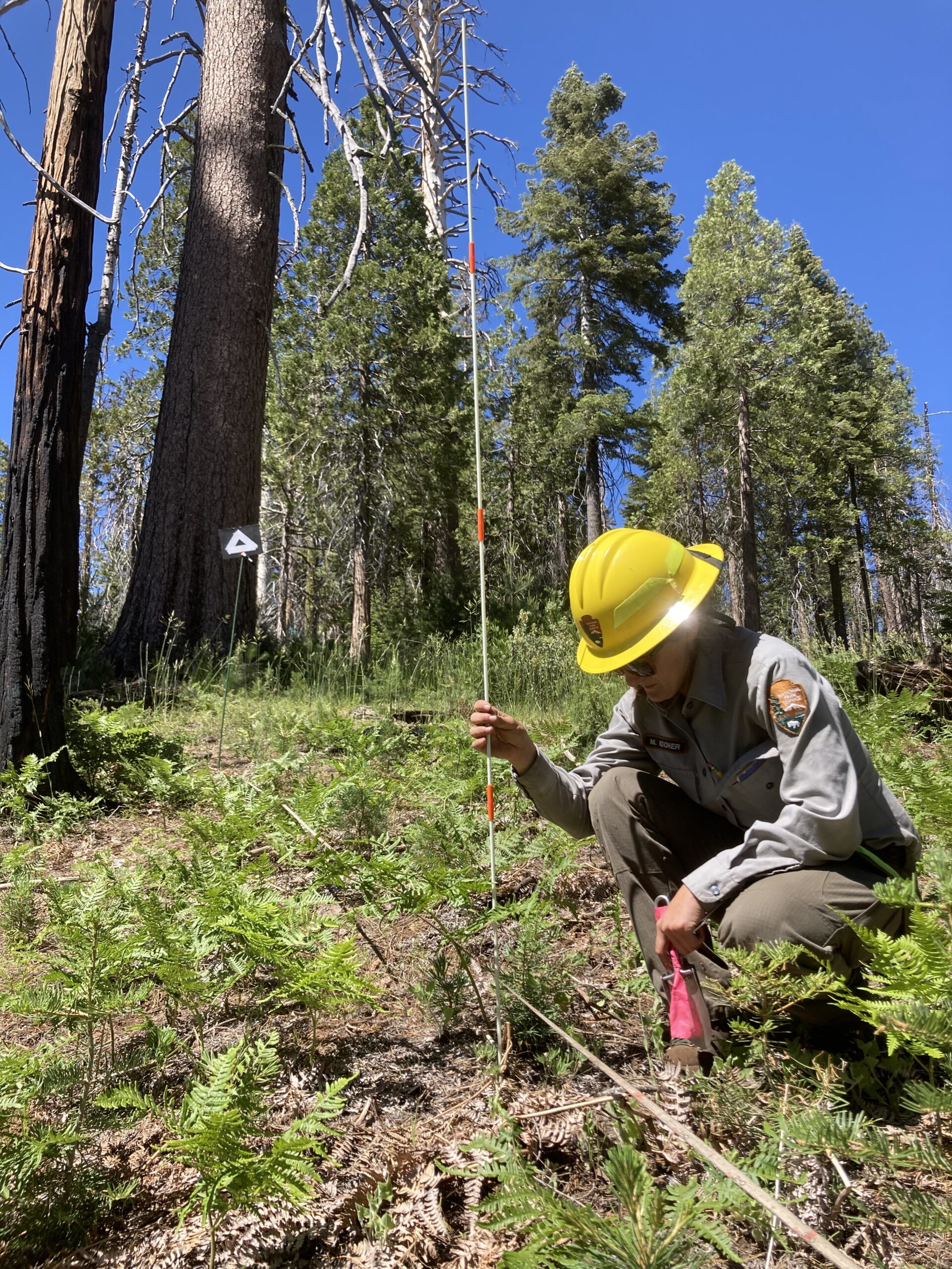
NPS technician Melissa Booher surveys plants along transects associated with terrestrial lidar plots. Image courtesy of Chad Anderson/NPS.
Lidar also plays well with other technology, such as GPS (global positioning system). This year, park researchers will unite lidar forest structure data with songbird location data to evaluate desired conditions for a suite of songbird species that breed in Yosemite. Together, these rich data sets will help park managers develop restoration plans to maximize habitat for bird species and communities. Prolonged droughts and fires are changing forests and meadows, making it increasingly vital to have tools, such as lidar, to look forward at the effects of climate change and act accordingly to make Yosemite’s habitats more resilient for songbirds and other wildlife. “We want to protect and maintain as much of the birds’ natural habitat as we can,” says Dr. Sherill Ladwig, who along with her wife, helps to financially support this vital songbird research.
Sarah Stock, a Yosemite wildlife ecologist, is also using a number of technologies, ranging from ground-based terrestrial lidar to GPS tracking, to assist her research into Pacific fishers and great gray owls.“ Both aerial and ground-based remote imaging are useful,” Stock says. “Lidar gives us different values and lets us see habitat in slightly different ways. It’s a tool that enables us to zoom in and zoom out on the landscape. We might have a point on the map where we know there’s an animal, based on their GPS collar as a data point, or visual observation. Using lidar, we can zoom in on what individual animals are using on the landscape. Is their presence associated with canopy cover, big trees, open areas, etc.? We are then able to map those attributes and learn more about the habits of different animals. By integrating aerial and ground-based lidar technology, we hope to leverage both top-down and ground-up perspectives.”
Integrating both aerial and terrestrial lidar data is essential to the success of multiple projects, as they work to create a holistic 3D map of Yosemite, including everything from bare earth to animal behavior patterns. Lidar is a perfect complement to fieldwork, and it offers a more granular view of habitats. “Animals have evolved to live in Yosemite for thousands and thousands of years,” Stock says. “They can adjust, but only if they have the habitat left.” She works closely with Anderson to figure out how to manage fires on the landscape. “We have a lot of capacity to protect what we have,” she adds. “It’s more challenging to try to improve what’s already been changed. When a high-severity fire comes through and burns hot enough to remove the canopy cover or the big trees, you can’t bring those back, so we have to protect what we have, and we have to identify what we have first. That’s where technology comes in.”
“We’ve never had this much data before,” Anderson says. “Our partnership with Yosemite Conservancy allows us to see the park in new ways.”
This was written by Megan Orpwood-Russell for the Spring/Summer Yosemite Conservancy Magazine (published in May 2022). Click here to read the magazine in full. Read more about how the park is using lidar in A Lidar’s-Eye View of How Forests Are Faring published in Eos in April 2022.