Back to Wilderness Hub | Dispersed Camping | Designated Wilderness Campgrounds
Our trailhead quota system dictates where and when you start your hike, and in some cases, where you can camp on your first night.
Explore examples of where you can camp and how to indicate this on your reservation.
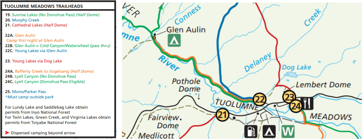
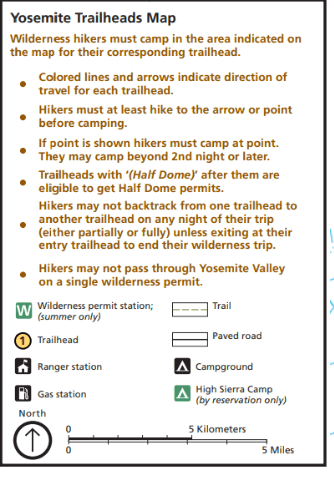
All trailheads have a direction of travel and minimum distance you must hike from your starting point before looking for a place to camp. The wilderness camping boundary is four miles from Yosemite Valley, Glacier Point, Hetch Hetchy, Tuolumne Meadows, and Wawona; and one-air mile from any road.
Dispersed Camping
Go the (minimum) distance!
For dispersed camping, once you hike the minimum distance, you can look for a place to camp, subject to wilderness regulations. (add link)
The Wilderness Trailheads Map (add link) shows the location of each entry point and the direction and distance you must hike before finding allowable camping.
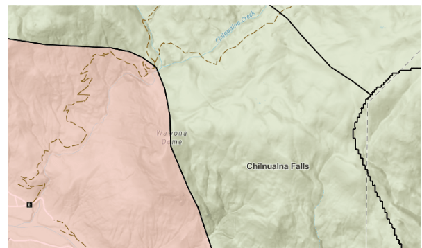
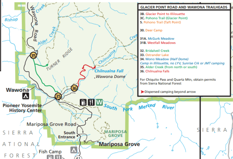
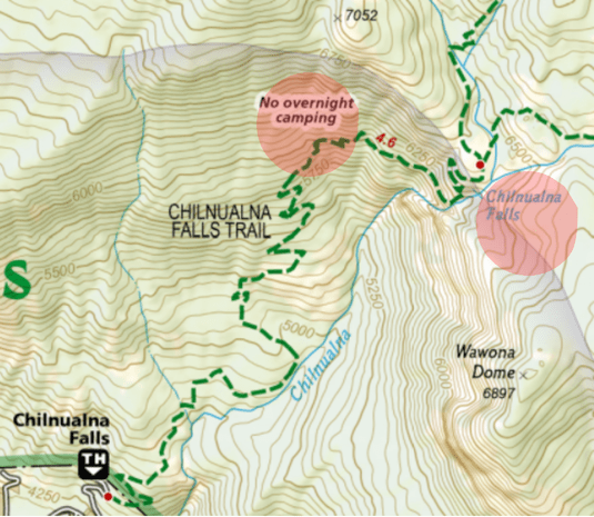
In this example, Chilnualna Falls trail is indicated by a red arrow following the trail to the wilderness camping boundary. Once you make it past the arrow, you can look for a place to camp.
Click here to view the full map.
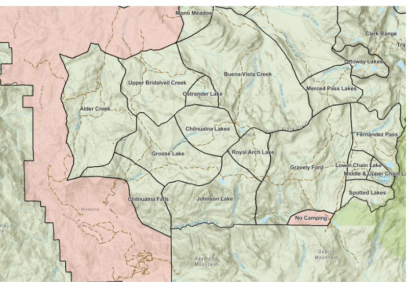
No-camping zone
The Camping Area Map shows the no-camping zone in Yosemite National Park.
It’s divided into different camping regions that correlate with the camp area selection menu on Recreation.gov.
Use this map to make sure your desired camping location is outside of the no camping zone before making your reservation.
The no camping zone is shown as the red shaded area. Some areas are in the no camping zone, but have designated wilderness campgrounds.
Click here to view the full map.
Jump to: Designated Wilderness Campgrounds
Let’s continue with the Chilnualna Falls example from ‘Where do I begin?’
You want to start at the Chilnualna Falls trailhead because the trail descriptions page says Wawona has less crowds, and you can hike near a waterfall. But where specifically are you going to camp?
After looking at a topographic map, you decide to hike the Buena Vista Lake Loop over four days.
You decide you just want to hike the minimum distance required on the first day. In this example, just beyond the top of Chilnualna Falls* is outside the no-camping zone, and this first place you can camp on this route.
*This is precisely what you should type on your reservation in the “Comments” section.
Source: National Geographic
Carrying a paper topographic map is essential for backpacking, as technology often fails. You can purchase topographic maps like the one pictured from our shop!
You are required to select a first night’s camping area on your reservation.
In this example, you would need to select Chilnualna Falls from the drop-down menu on Recreation.gov.